The 800-mile Arizona National Scenic Trail (AZT) is as beautiful as it is daunting. It crosses the state, from Mexico to Utah. It travels up and down Sky Island mountain ranges, across the Saguaro-studded Sonoran Desert, through the largest Ponderosa Pine forest in the world, past Arizona’s highest peak, and from rim to rim of the Grand Canyon. But you don’t need to hike the entire route to experience its historical, geological, and botanical significance. Many scenic views and important sites are accessible within a few hours’ journey.
Trail expert Sirena Rana guides you along the most interesting and accessible portions of the trail in 30 carefully crafted routes. Each entry includes navigational information and interpretive facts about the trail’s cultural history, natural history, and geography.
Inside You’ll Find:
30 hikes through the most scenic and significant portions of the trail
In-depth route descriptions and fun facts
Detailed maps and full-color photographs that highlight Arizona’s diverse environments
Information on area food, activities, and lodging
This guidebook was created in partnership with the Arizona Office of Tourism and published by Wilderness Press. It is perfect for casual and experienced hikers alike, so get out there and enjoy the trail!
Exciting announcement: I’ve created a Patreon community at Patreon.com/desertsirena! Join now to get videos, newsletters, digital downloads, my upcoming guidebook, prints and behind the scenes content for my writing, photography and trail design. For a limited time, you can get even your name listed in my upcoming book, Best Day Hikes on the Arizona National Scenic Trail!
Patreon is a monthly subscription-based site and I’m thrilled to create a community of folks who want to learn about and be inspired by the outdoors. Support from Patreon will allow me time to produce content, promote my current book and get started on the next one. And I’ve got a fantastic idea for my next book…
Each month, you’ll receive a newsletter exclusively for my Patreon community with information on what projects I’m working on and any events, podcasts or articles I’ve been featured in. I love sharing what I know about hiking, backpacking, the desert and how to get started in the outdoors. You’ll get an inside scoop on my trips, whether it’s packing for a weeklong backpack or just walking around and appreciating nature close to home.
For the first time, I’m providing a peek behind the scenes at my process for writing, photography, travel, and trail design and development. I look forward to sharing because I believe that people get inspired to do things they might have never thought possible by seeing how others do it.
Everyone who joins will receive a Sonoran Desert Wildflower Guide, discount codes for Gossamer Gear and Huppybar, and be entered in a raffle to win one of five Gossamer Gear Bumster fanny packs. Join at Patreon.com/desertsirena and share the link with your circles!
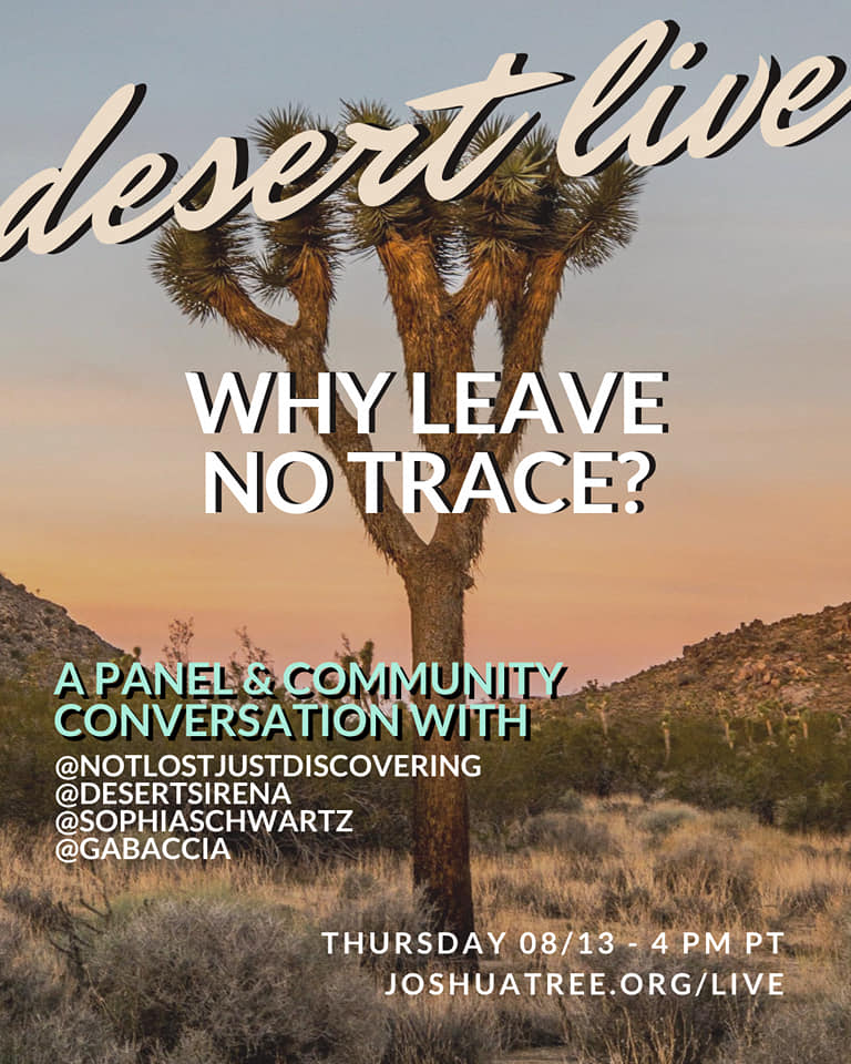
I’ll also be a part of a panel discussion with Joshua Tree National Park Association on Thursday, August 13th at 4pm PT called Why Leave No Trace? The link to join the event is https://www.joshuatree.org/live/ and here’s the overview:
As our public lands and outdoor spaces gain increasing popularity, it is our responsibility as good guests and visitors to make sure these spaces can be enjoyed by future generations. Hence we are faced with the challenge of minimizing the impact of millions of us who are eager to explore the great outdoors.
When we talk about Leave No Trace (LNT), we talk about caring for the natural resources of the places we come in contact with through self-awareness. But, why should we Leave No Trace? Who practices these principles, and who is left out? Why is that?
In this panel and open discussion with live audience members, we intend to explore the big questions of WHY that surround each of the 7 Leave No Trace principles and the idea of Outdoor Ethics as a whole.
Hope you can join in! It will also be available after the event at this link. I also did an interview on Instagram with JTNPA to talk about my experiences with the outdoors, trail design and the upcoming book.
The last time I posted, I was excited about the coming year and all it held. Little did we all know that 2020 would be different than any of us expected due to COVID-19. I was visiting Michigan and Chicago in early March when everything suddenly changed. I returned home to Tucson on March 15th and have been trying to navigate life ever since. My heart goes out to all who have lost family, friends, jobs and opportunities to this pandemic.
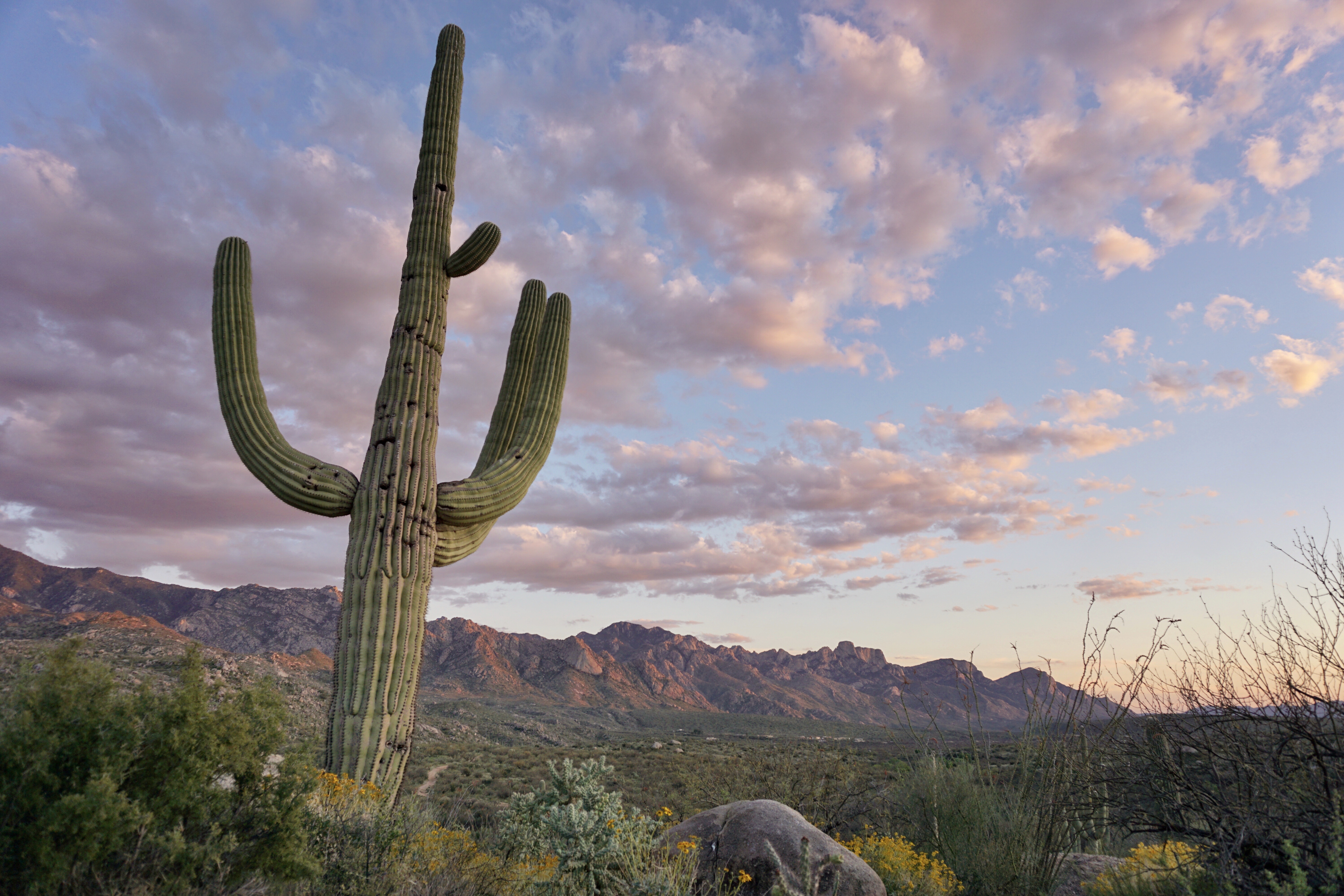
Sunset in the Catalina Mountains
I’d like to take a moment to remember Ahmaud Arbery, a black man chased down while jogging and shot by white supremacists in February. The murderers were only apprehended last week and only after a video of the chase and the shooting was circulated publicly. No one should have to fear for their life while trying to enjoy the outdoors. No one.
RIP Ahmaud Arbery
Here’s updates, some good, some bad:
First, some good news: I am going to be on the Unlikely Hikers Podcast today, Tuesday May 12th at 5pm PST! It’s a storytelling episode, you can see the live Zoom show at jennybruso.com/podcast or listen to the audio anytime. Unlikely Hikers is such a wonderful community, their group hike was one of the last outdoor events that I attended before COVID-19 took over and I am thrilled to be on the show. It’s a special day because it’s the 11th anniversary of completing the Arizona Trail for the first time and also Fibromyalgia Awareness Day. I hope you’ll head over and listen!
Now for bad news: my book, Best Day Hikes on the Arizona National Scenic Trail, has been postponed until August. Yet another thing affected by the pandemic. I had also planned on a multi-city book tour, which seems unlikely now. I’m working with my publicist at Wilderness Press to figure out virtual and livestreaming events instead. Email sirena@trailsinspire.com to be on the mailing list for the latest book updates.
Arizona Trail Super Gate near Oracle
I am also in the process of putting together a Patreon account, where folks will be able to subscribe to access exclusive content, videos, Q&A, and trip planning, as well as receive advance information about events and livestreams. Maybe even a level that will include exclusive Micro Chicken content! In the meantime, if you’d like to support my work, you can Venmo me a tip at @desertsirena or PayPal at sirena@trailsinspire.com.
Micro Chicken and Ocotillo Bloom
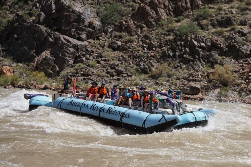
Good news: Last week was supposed to be my return to guiding in the Grand Canyon. I got hired back with Arizona River Runners to work their 3-day trips that go from Las Vegas to the Bar 10 Ranch, spend one night, and then helicopter down to run 90 miles on the Colorado River in a boat with another night on a beach in the Canyon. Here’s a video that shows the trip:
Bad news: Grand Canyon National Park is currently closed until at least June 13 (as of now) and there’s no telling when it will again be safe to open it to run this kind of trip. It’s been five years since I last guided on the river. Here are a couple memorable moments from the seasons I was lucky enough to spend down there.
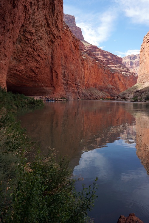
Cheering at the end of Hermit Rapid at 22,000 cfs, the most fun on the whole river!Redwall CavernGiving an archaeology talk at the Whitmore Pictographs
Bad news: I am in a fibromyalgia flare because of all the stress and anxiety surrounding COVID-19. Stress is one of the biggest contributing factors to my flares. I also had a small calf muscle tear occur on May 2nd that has limited my mobility. It’s not as bad as the muscle tear that required me to be helicoptered out of the Grand Canyon, but it’s definitely going to take some time to heal.
Times are tough, uncertain and ever-changing. I have so much gratitude for the essential workers who have kept our country going during the pandemic. If you’d like more frequent updates from me, follow my Instagram. Stay safe and healthy, everyone!
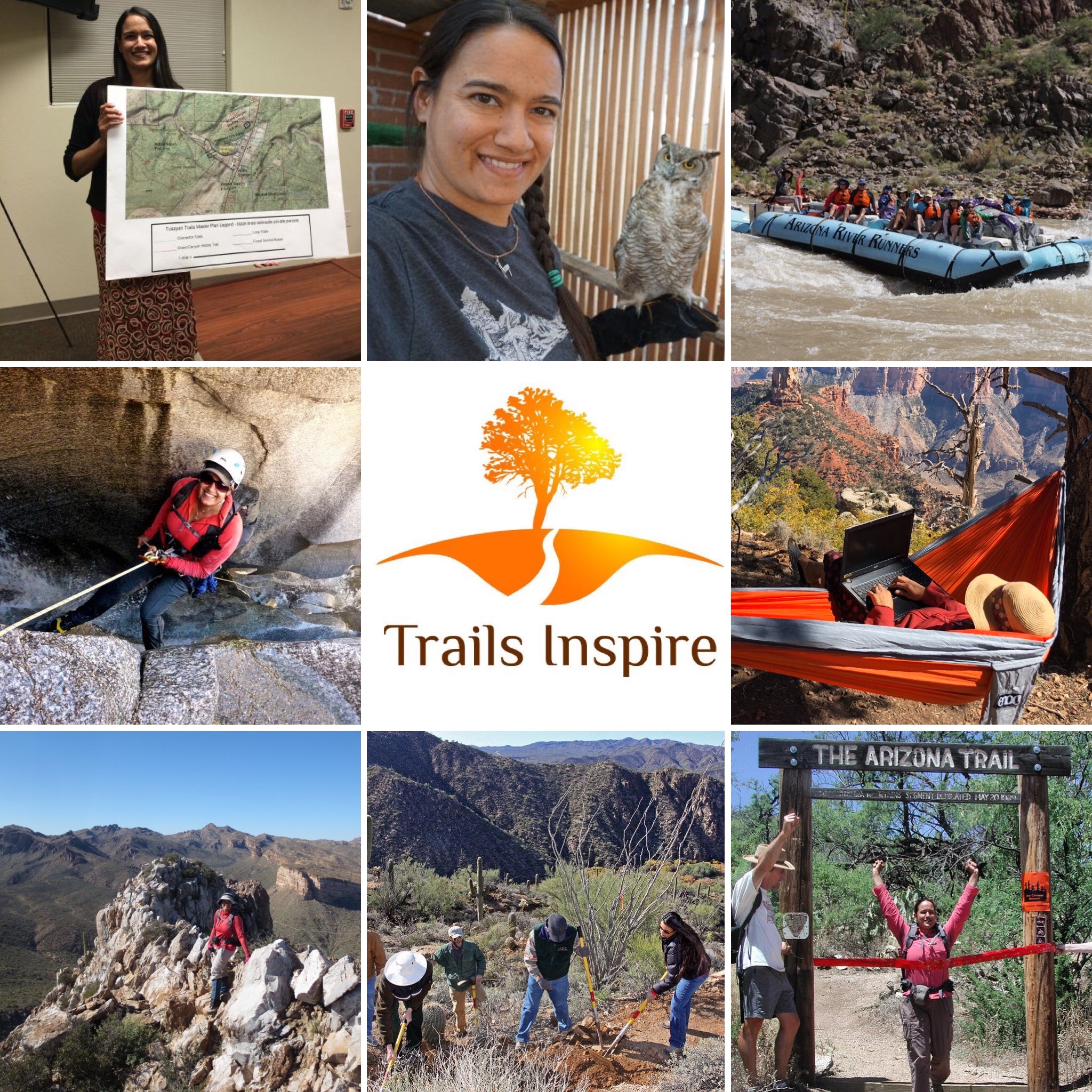
Happy 2020! This was the first time that I used the One Second Everyday app to record the events of the year. I really enjoyed the experience, it gave me a reason to capture memories of friends, places visited, days at home, and work at my consulting company, Trails Inspire. If you’d like more frequent updates on my wanderings, follow me on Instagram at @desertsirena and @trailsinspire. I’d recommend watching the video below full-screen.
Top 10 2019
Finishing my manuscript for Day Hikes on the Arizona National Scenic Trail
Wildflower superbloom
Visiting family in India after 16 years
Snow in the desert (three times!)
Women on the Road Campout
Wrote and was quoted in quite a few articles and featured in podcasts
Danced a lot
Grand Canyon trips for Anish’s wedding, Diversity workshop and book celebration
Colorado trips for Summer Outdoor Retailer, road trip with my Dad and Project 16x
Thanks to my sponsors, Gossamer Gear, Huppybar and Purple Rain Adventure Skirts for providing me food and gear for my adventures and travels, and thanks to Wilderness Press and the Arizona Office of Tourism for support on my book, which will be released in the Spring. And as always, grateful for my husband Brian’s support of my hopes and dreams.
This year, I am grateful to have visited the ancestral lands of the Tohono and Akimel O’odham, Yaqui, Chiricahua Apache, Western Apache, Havasupai, Hopi, Hualapai, Navajo Nation, and the Yavapai-Apache, Ute and Cheyenne.
Looking forward to putting together my book tour, doing more sections of my Grand Canyon Traverse (hopefully this is the decade I complete it), and trail design and development projects in 2020. Thanks to all who have followed along! If you’re looking for a retrospective about the last decade, check out my post on Ten Years of Sirena’s Wanderings.
Top 10 of the decade with photo collage:
Starting Trails Inspire and creating a career promoting the outdoors
Writing my first book, Day Hikes on the Arizona National Scenic Trail
Working as a rafting guide on the Colorado River
Finishing the Arizona Trail twice
Grand Canyon Traverse segments
Volunteering at Wildlife Rehabilitation in Northwest Tucson
Arizona Trail Gateway Community Program
Developing my photography skills
Off-trail travel and scrambling, canyoneering and climbing
Trail Design
Wishing you exciting adventures and personal growth in the coming year, if you’d like to be on the mailing list for the book release and tour, shoot me an email at sirena@trailsinspire.com.
Happy National Take a Hike Day! This week marks the 10-year anniversary of my blog, Sirena’s Wanderings, thanks to all who have followed along! Whether you’ve found me recently or been reading for years, I appreciate being able to share my stories with you.
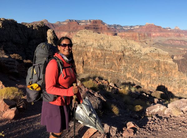
Sirena in her natural habitat on a week-long solo trip in Grand Canyon
I haven’t been posting on the blog much because I have been so busy the last year and a half with my book project, Day Hikes on the Arizona National Scenic Trail. I am thrilled to announce that the first draft of the manuscript was turned in to Wilderness Press on November 1st! It was a phenomenal amount of hiking, writing, photography and research.
The book is geared toward beginners and features the very best sections of the Arizona Trail that are accessible via day hike. Each hike has interpretive information so you can learn about the geology, history, geography, botany or archaeology of the area where you’re hiking. It’s got Gateway Community information so you know the best places to eat and stay after your hike and a section where I share my desert hiking tips and tricks. The projected release date is Spring 2020, send an email to sirena@trailsinspire.com to sign up for my email list for all the details on the book release and tour.
Wildflowers on the Arizona Trail along the Gila River – Ancestral lands of the Akimel O’odham
The way that Sirena’s Wanderings came about is that in 2008-09 I section-hiked the Arizona Trail to raise awareness for Fibromyalgia and kept a website for it. I enjoyed sharing my adventures so when that hike was over, I started this blog.
The 11 Traditionally Associated Tribes of Grand Canyon are: Havasupai Tribe, Hopi Tribe, Hualapai Tribe, Kaibab Band of Paiute Indians, San Juan Southern Paiute Tribe, Las Vegas Band of Paiute Indians, Moapa Band of Paiute Indians, Paiute Indian Tribe of Utah, Navajo Nation, The Pueblo of Zuni and the Yavapai-Apache Nation.
It’s interesting to think of what my life was like back then and how much things have changed. 10 years ago, I had finished my great adventure of section-hiking the Arizona Trail but I had no idea of what the future held. Finishing the AZT was something that had seemed impossible only years earlier, when I was still very sick from Fibromyalgia. I have had this chronic pain condition now for 22 years and though I manage it well, I still have flares from time to time.
I had no idea what was next, but my experiences on the AZT showed me that I could push myself farther than I’d ever imagined. It gave me the confidence for the things that followed: becoming a public speaker and advocate for the outdoors, taking on increasingly difficult outdoor pursuits, getting my jobs as the Gateway Community Liaison for the Arizona Trail Association and as a guide on the Colorado River in Grand Canyon, and ultimately starting my consulting business, Trails Inspire and writing this book. What a journey! For example, 10 years ago I’d never imagined I’d be doing this:
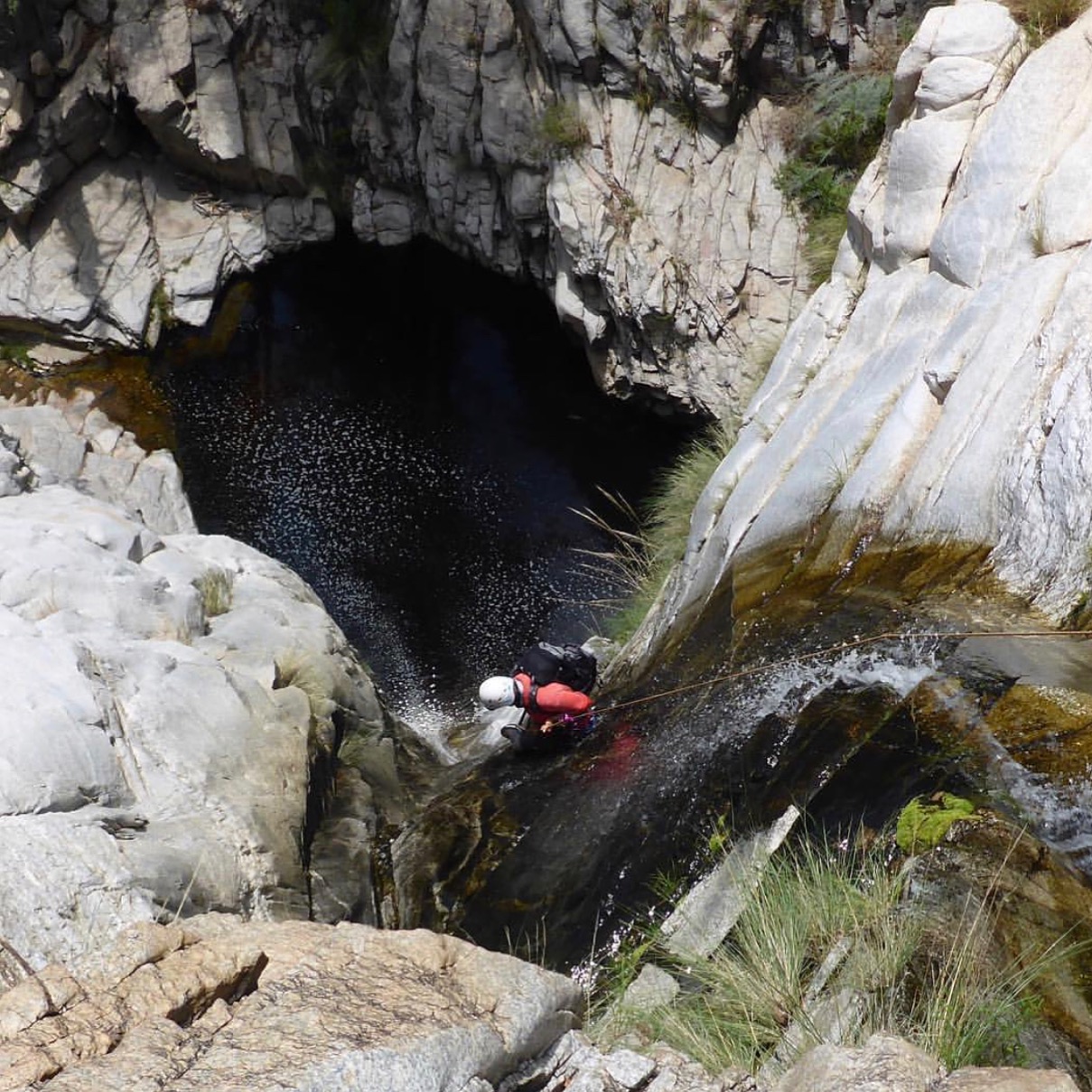
Rappelling down Willow Canyon, photo Russell James Newberg. Ancestral lands of the O’odham and Yaqui
Wanted to share some articles I’ve been featured in or written, click the links below to read. First is “How to Travel Through the Desert Like a Pro” by Meg Atteberry on the REI Co-op blog, where I share my tips on desert hiking, backpacking and camping.
Paul Fiarkoski of Arizona Wonders attended my talk on Hiking the Arizona Trail for the Arizona Mountaineering Club and wrote up a great article on my story and the AZT.
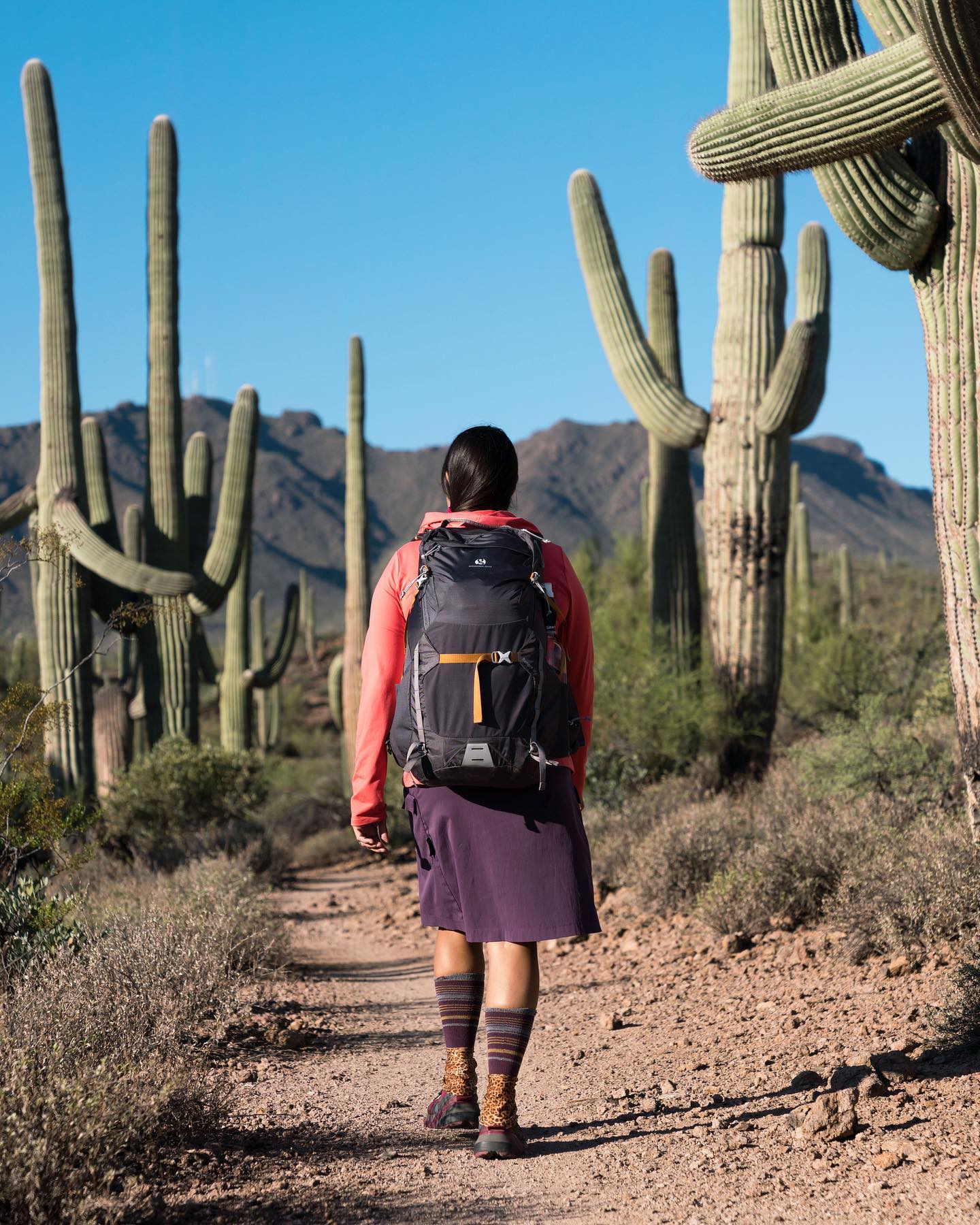
I wrote an article for the Gossamer Gear blog on Tips and Techniques for Dry Camping. It’s a valuable skill to have, especially in the desert. Also reviewed the Ranger 35 daypack and the Silverback 55 backpack I’ve been using for my latest trips.
Ranger 35 backpack – Photo by Travis Perkins. Ancestral lands of the O’odham and Yaqui
Grateful to Gossamer Gear for their continued support and proud to be a part of their Ambassador program for many years now. I’d also like to give a shout-out to Huppybar, Purple Rain Adventure Skirts and the Arizona Office of Tourism for their partnerships!
I was featured in Etched Magazine, talking about my favorite hikes and snacks for on and off the trail.
Goat cheese, dates and bacon in Grand Canyon
One of my favorite podcasts, She Explores, interviewed me about my volunteer work with Wildlife Rehabilitation in Northwest Tucson. Here’s a video that I made of babies and releases. I also set up a new website for the rehab where you can donate!
Apache Lake Vista – Ancestral lands of the Apache and Yavapai
After I turned in my book manuscript, it was time to celebrate. And there’s no place I’d rather celebrate than Grand Canyon! I got a permit for three nights in the Hermit and Granite Rapids area and had the most fantastic solo trip. All I wanted to do is sit and watch the river, listen to Granite Rapid, do photography and enjoy my time in the Canyon. It was exactly what I needed.
Hiking down the Hermit Trail, Grand Canyon
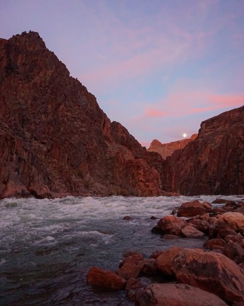
Sunset and Moonrise at Granite Rapids, Grand Canyon
Granite Rapids at night from the high scout point
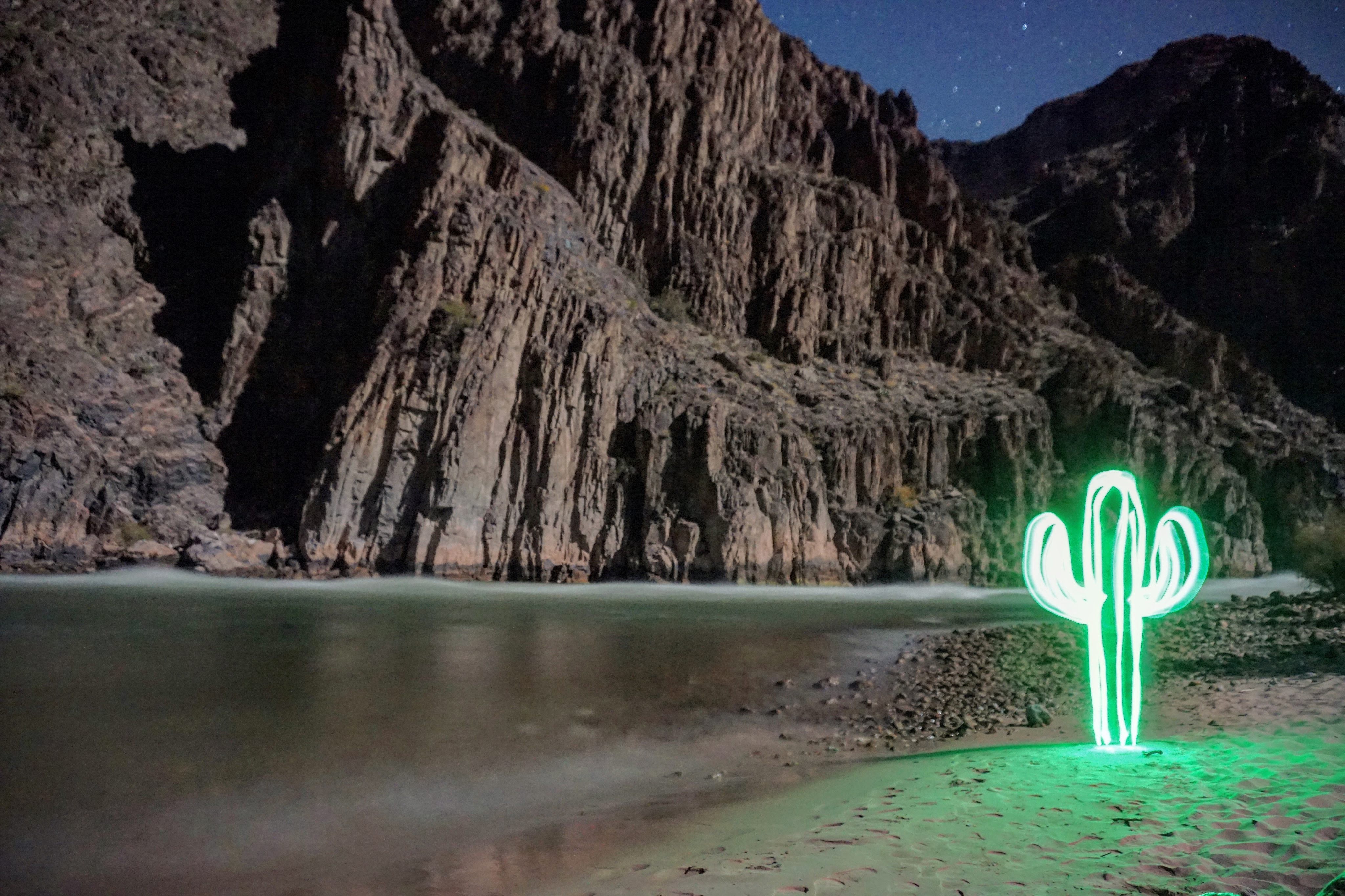
Light painted a Saguaro on Granite Beach, Grand Canyon
Sunset while hiking out the Hermit Trail, Grand Canyon
Here’s an old video of me driving a 32′ boat through the same rapids, back in 2013 when I worked for Arizona River Runners. Not the greatest quality, but gives you an idea of scale. Back when I started this blog 10 years ago, I’d never driven a boat before.
I have had to put my Grand Canyon Traverse on hold for the last year and a half for this book project, and this trip has energized me to get back to section-hiking the remainder of the Canyon. It’s going to take some training to get strong enough for off-trail travel with a big pack, but I’m ready for the challenge.
Retrospectives are always fun for me, especially because it gives me the chance to wonder where I’ll have wandered in 10 more years! Thanks again for reading.


 Now for bad news: my book, Best Day Hikes on the Arizona National Scenic Trail, has been postponed until August. Yet another thing affected by the pandemic. I had also planned on a multi-city book tour, which seems unlikely now. I’m working with my publicist at Wilderness Press to figure out virtual and livestreaming events instead. Email sirena@trailsinspire.com to be on the mailing list for the latest book updates.